

Wanderkarten mit Tourenvorschlägen Kümmerly+Frey
Switzerland, Jura, Nr. 15, Hiking maps with routes 1:50'000 / german edition

Article Number: 978-3-8283-1053-7
Scale: 1:50 000
This product is in stock.
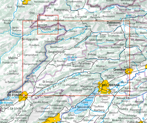
In the Kümmerly+Frey Hiking Map Jura Franches-Montagnes at a scale of 1:50,000, the most beautiful hiking routes in the region have been compiled for you.
The map shows from Damvant, Saint-Ursanne, Delémont, Moutier, Biel/Bienne, La Chaux-de-Fonds, Col du Chasseral, Tavannes, Tramelan, etc., the major areas of interest. Thanks to clearly marked, easily readable, and up-to-date hiking trails, the organized map layout, and clear terrain representation, the map is the perfect tool to make the most of your visit to this exceptional region. With the hiking route suggestions marked on the map, you can easily find an adventure in your area.
The map includes detailed topographic information such as contour lines, as well as elevations for mountain peaks, passes, and larger lakes, providing a precise representation of the terrain. In collaboration with Outdooractive, we have incorporated all the essential information about the proposed, most beautiful routes: important details about elevation profiles, hike durations, restaurants, bus stops, and much more!
The folding map for hikers is made of sturdy, largely water-resistant, and tear-resistant paper. Even in challenging weather conditions, it won't let you down.
If the GPS isn't working or your phone is out of battery, the clearly marked hiking trails, viewpoints, train stations, dining options, campgrounds, parking lots, etc., on the map will always help you keep your orientation.
As a complement to Hiking Map No. 15, we recommend the maps of neighboring regions:
- Switzerland, Basel-Landschaft, No. 09, Hiking Map 1:50,000
- Switzerland, Bern-Gantrisch, No. 12, Hiking Map 1:50,000
About Hallwag Kümmerly+Frey:
We, at Hallwag Kümmerly+Frey, aim to inspire people to explore the world. Our road maps, city plans, hiking maps, cycling maps, etc., stand out for their up-to-date information, precise cartography, well-researched routes, and clear layout, ensuring optimal planning and travel. Start your adventure well-prepared with us!
Free shipping in Switzerland*
20% discount for 3 items
* Except for bulky good deliveries (posters)
Digital maps
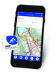
PLAN, DISCOVER, EXPERIENCE - on the web and mobile!
Download our HKF Outdoor App!
Navigator
More than 1000 Web-Sites in 47 countries! Listing of important European Web-Sites supporting your planning and booking of journeys.