

Themenkarten Kümmerly+Frey
Switzerland, political map 1:600'000

Article Number: 978-3-259-00172-1
Scale: 1:600 000
Valid until: 2028
This product is in stock.
The folding political map of Switzerland at a scale of 1:600,000 depicts Switzerland with its color-highlighted cantons.
The map covers all the locations in Switzerland, from Geneva, Biel, Basel, Schaffhausen, Winterthur, Chur, Bern, Thun, Sion, Lugano, etc.
Thanks to the clearly marked color-coded borders, the cantonal boundaries are instantly recognizable at a glance. With clear border lines and carefully crafted cartography, this folding map is an essential tool for students, scholars, teachers, and anyone interested in national affairs.
In addition to the color-highlighted cantons, the map also indicates the major highways, connecting roads, and road numbers. The labels on the map and the legend are provided in German, French, Italian, and English.
The folding map in a 24 x 11 cm format is the optimal product for educational purposes.
About Hallwag Kümmerly+Frey
At Hallwag Kümmerly+Frey, our goal is to inspire people to explore the world. Our road maps, city plans, hiking maps, bicycle maps, etc., stand out for their up-to-date information, precise cartography, well-researched routes, and clear layout, making planning and the journey itself a breeze. Start your adventure well-prepared with us!
Free shipping in Switzerland*
20% discount for 3 items
* Except for bulky good deliveries (posters)
Digital maps
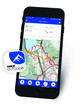
PLAN, DISCOVER, EXPERIENCE - on the web and mobile!
Download our HKF Outdoor App!
Navigator

More than 1000 Web-Sites in 47 countries! Listing of important European Web-Sites supporting your planning and booking of journeys.