, Road Map 1:600'000")
, Road Map 1:600'000")
Strassenkarten Kümmerly+Frey
France (North), Road Map 1:600'000

Article Number: 978-3-259-01833-0
Scale: 1:600 000
This product is in stock.
In the Kümmerly+Frey Road Map France (North) at a scale of 1:600,000, you will find everything you need for orientation and inspiration.
The map shows the main areas of interest from Basel, Strasbourg, Metz, Dijon, Bourges, Paris, Le Mans, Rennes, Nantes, Rouen, Lille, Calais, Brest, etc.
Thanks to the clearly marked, easily readable, and up-to-date roads, as well as the clear and current map image and detailed accuracy, this map is the perfect tool to make the most of your visit to this exceptional region.
The thematic map contains detailed information about towns and the connecting road network. Travelers by car or motorcycle will easily find their way thanks to clearly marked and well-presented highways, national roads, main roads, country roads, and secondary roads. Integrated transit plans help navigate around cities. With the integrated distance table, you can easily calculate distances between departure and arrival points and plan the required time. Integrated ferry connections also ensure you reach your destination. The attached six-language brochure with a locality index, legend, political map, travel information, and tips completes the map.
The foldable map for car drivers or motorcyclists is made with a sturdy cover and robust paper. Even after repeated use, it won't let you down.
If the GPS doesn't work or your phone runs out of battery, the roads, viewpoints, train stations, dining options, campsites, parking areas, etc. clearly marked on the map will always help you maintain your orientation.
As a complement to the France (North) Road Map, we recommend the France (South) map, at a scale of 1:600,000.
About Hallwag Kümmerly+Frey:
We, Hallwag Kümmerly+Frey, have set ourselves the goal of inspiring people to explore the world. Our road maps, city maps, hiking maps, bicycle maps, etc. impress with their up-to-date information, accurate cartography, well-researched routes, and clear layout, ensuring optimal planning and travel experiences. Start your adventure well-prepared with us!
Free shipping in Switzerland*
20% discount for 3 items
* Except for bulky good deliveries (posters)
Digital maps
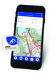
PLAN, DISCOVER, EXPERIENCE - on the web and mobile!
Download our HKF Outdoor App!
Navigator
More than 1000 Web-Sites in 47 countries! Listing of important European Web-Sites supporting your planning and booking of journeys.