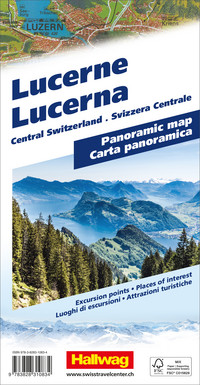
The Hallwag panoramic map of Lucerne reflects Central Switzerland in all its typicality and beauty.
It presents the region in a 3D image, thereby highlighting its special features. With visualized mountains, valleys, forests, and lakes, the map becomes something truly exceptional. The map shows the entire region, from Einsiedeln, Piz Terri, Sedrun, Klausen Pass, Altdorf, Schwyz, Lake Zug, Andermatt, Stans, Lake Lucerne, Lucerne, Furka Pass, Meiringen, etc., representing the main areas and points of interest and portraying their features as realistically as possible.
Thanks to the 3D representation and detailed illustration, the viewer is shown exactly what characterizes the region, what to expect there, or what they will recognize.
A multitude of indications about sights, viewpoints, mountain railways, and offers for active leisure activities complete the map.
The panoramic map for landscape lovers consists of a sturdy cover and very pleasant paper. Whether as a wall poster or as a tool for regional recognition: the map will not disappoint you.
About Hallwag Kümmerly+Frey
We, at Hallwag Kümmerly+Frey, are committed to inspiring people to explore the world. Our road maps, city maps, hiking maps, cycling maps, etc., stand out for their up-to-date information, most accurate cartography, well-researched routes, and clear layout, ensuring optimal planning and travel. Start your adventure well-prepared with us!

Free shipping in Switzerland*
20% discount for 3 items
* Except for bulky good deliveries (posters)
Digital maps
PLAN, DISCOVER, EXPERIENCE - on the web and mobile!
Download our HKF Outdoor App!
Navigator
More than 1000 Web-Sites in 47 countries! Listing of important European Web-Sites supporting your planning and booking of journeys.


