

Wanderkarten mit Tourenvorschlägen Kümmerly+Frey
Switzerland, Jungfrau Region, Grindelwald, No. 4, Hiking Tour Map 1:50,000

Article Number: 978-3-8283-0949-4
Scale: 1:50 000
This product is in stock.
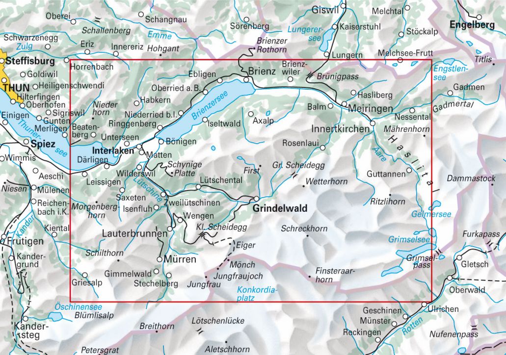
In the Kümmerly+Frey hiking tour map Jungfrau Region, Grindelwald at a scale of 1:50 000, we have compiled the most beautiful hiking routes in the region for you.
With clearly marked, easy-to-read, and up-to-date hiking trails, a clean and organized map design, and detailed terrain representation, this map is the perfect tool to make the most of your visit to this exceptional region. Thanks to the suggested hiking routes marked on the map, you'll easily find an adventure tailored to your interests.
The map includes detailed topographic information, such as contour lines and altitude details for mountain peaks, passes, and larger lakes, providing a precise depiction of the terrain.
In collaboration with Outdooractive, we have incorporated all the key details about the suggested tours: elevation profiles, estimated hiking times, restaurants, PostBus stops, and much more!
The foldable hiking map is made of durable, largely water-resistant, and tear-proof paper. Even under challenging weather conditions, it won’t let you down.
If GPS fails or your phone runs out of battery, the clearly marked hiking trails, viewpoints, train stations, restaurants, campsites, parking areas, and more on the map will help you stay oriented at all times.

Your benefit
Free shipping within Switzerland for 2 or more items*
* Excludes bulky items (posters)
No shipping to the USA
Due to current customs regulations, shipping to the USA is unfortunately not possible at the moment for cost reasons.
Thank you for your understanding.
Not found the right product?
Browse our extensive range – you’re sure to find the perfect one.