Are you planning a trip to Iceland this summer? Then a visit to the highlands should definitely be on your list: Spectacular natural landscapes, wild volcanoes and hot springs await you here. Places like Askja, Kerlingarfjöll, Landmannalaugar, Þórsmörk or the Laugavegur, which connects the latter two places on a 50 km hike, evoke feelings of longing in many an Iceland fan. With a rugged four-wheel drive vehicle, you will discover Iceland's barren stone deserts, untouched expanses and solitude in a whole new way.
Some say you haven't been to Iceland if you haven't been inland at least once. The Icelandic highlands cover an area of 40,000 square kilometres, roughly the size of Switzerland, and are still one of the largest uninhabited areas in Europe. Although you occasionally meet other vehicles on the few unspoilt highland routes, there is no comparison with the touristy south of Iceland.
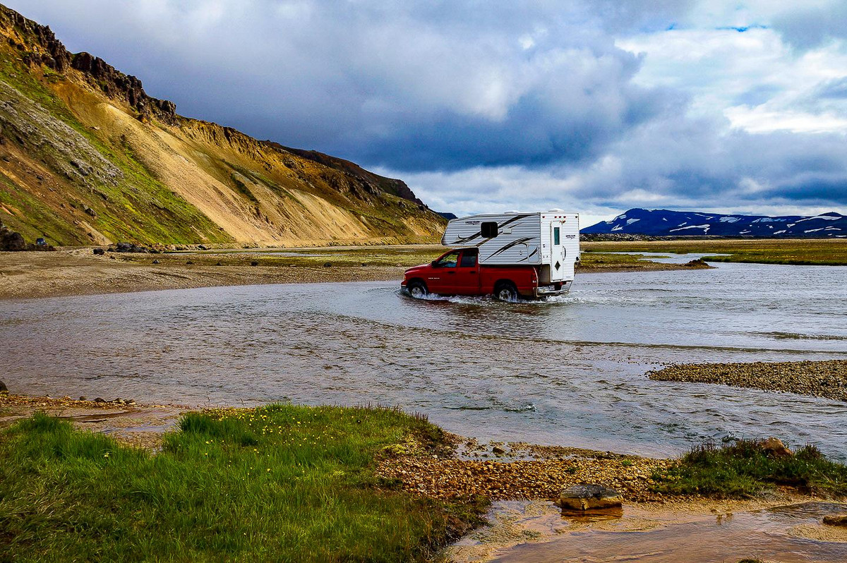
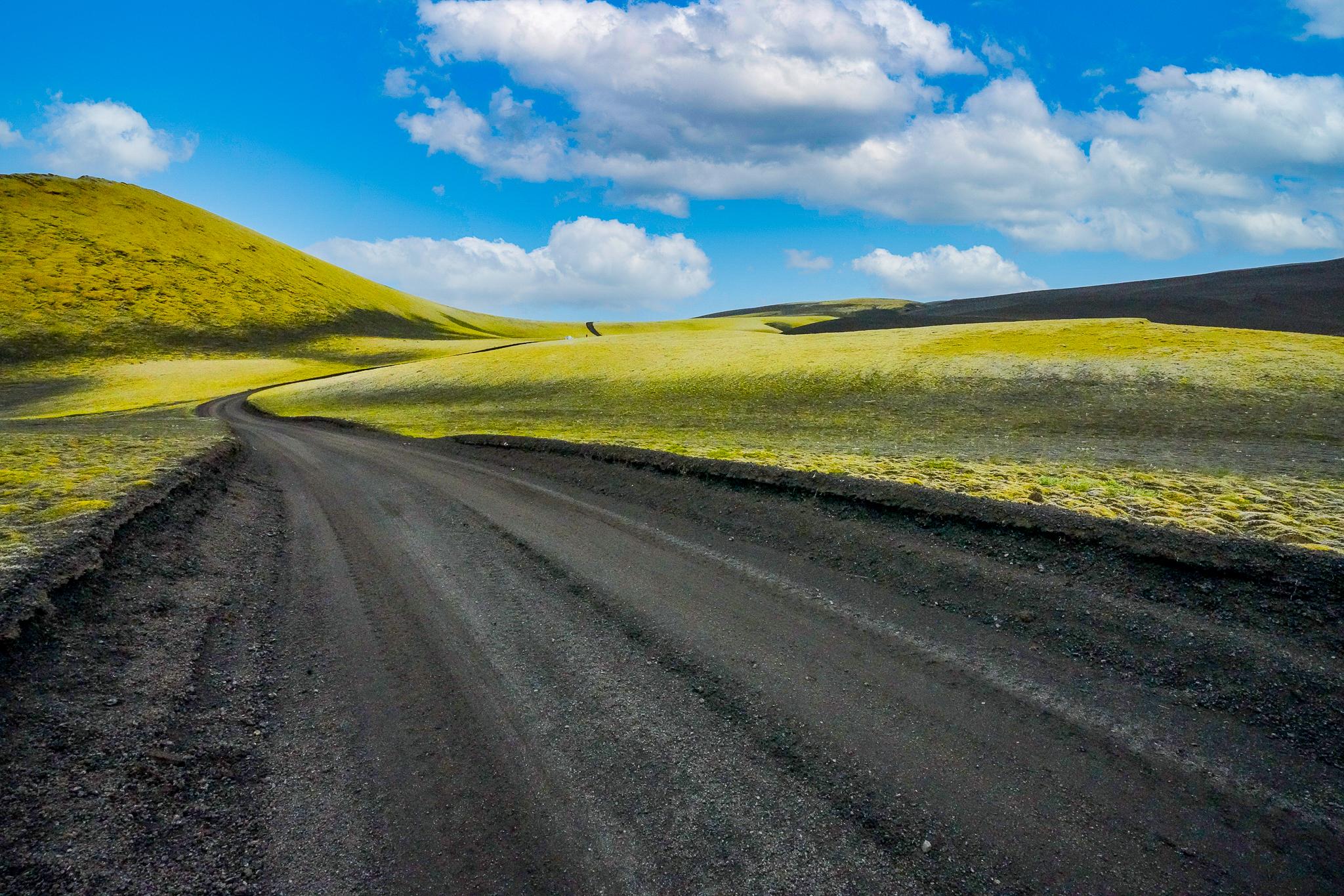
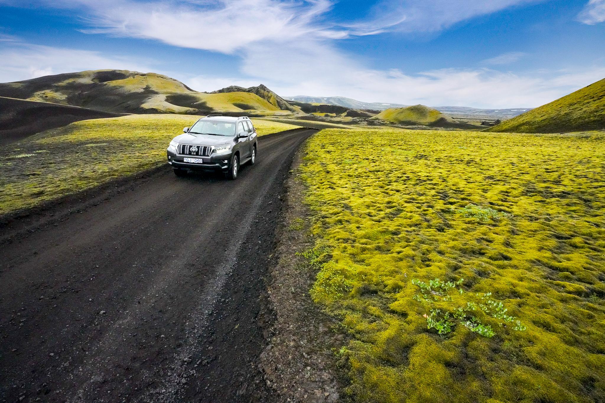
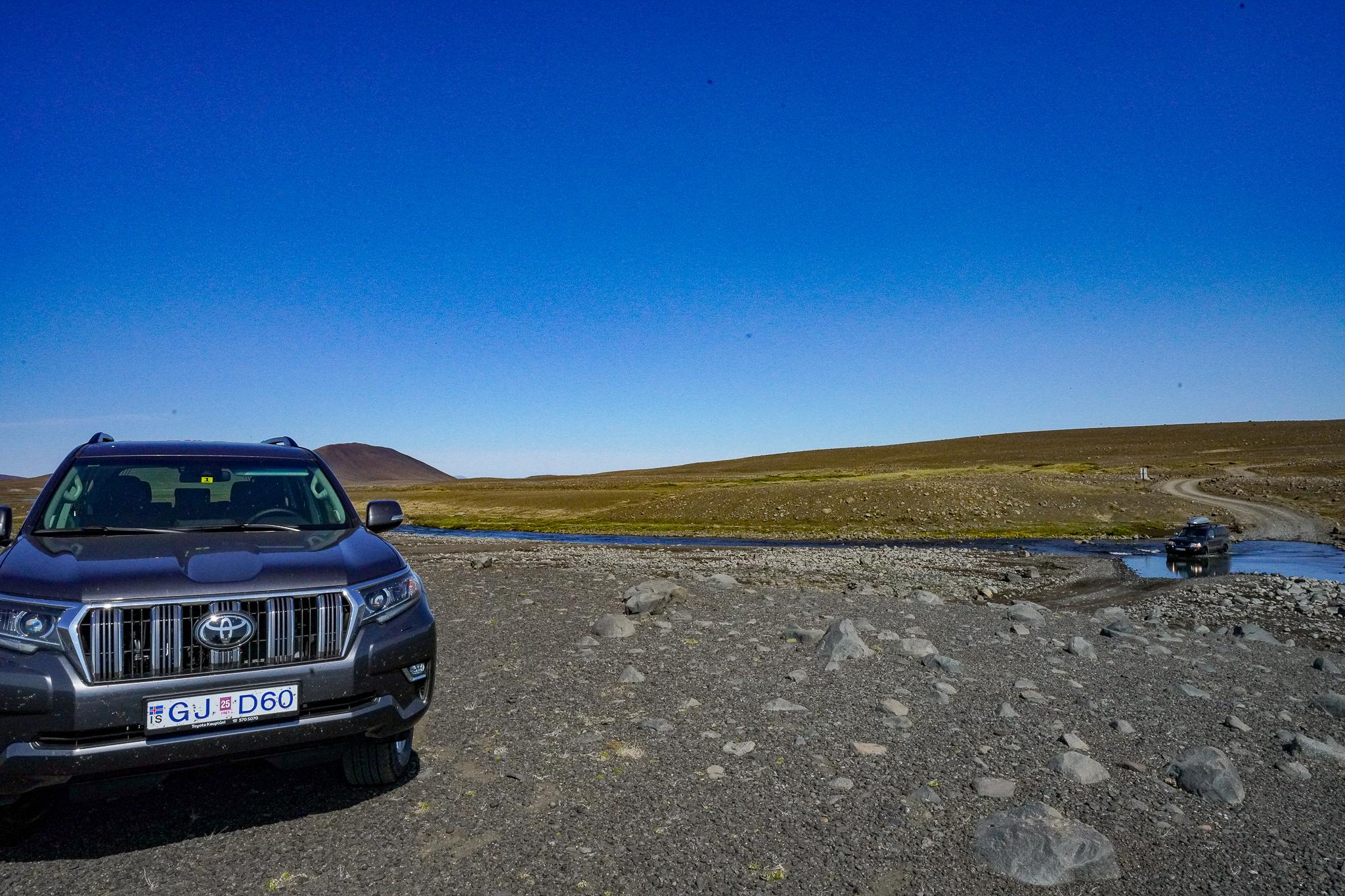
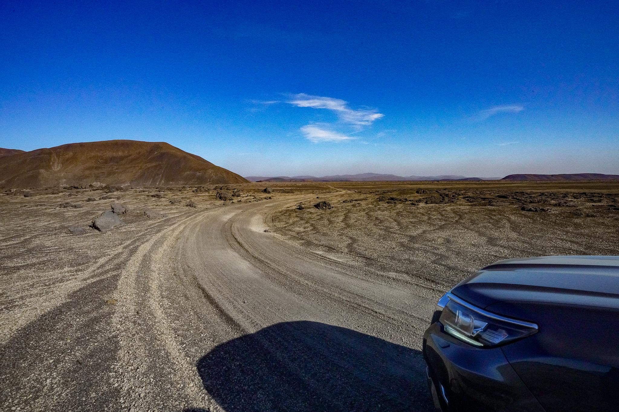
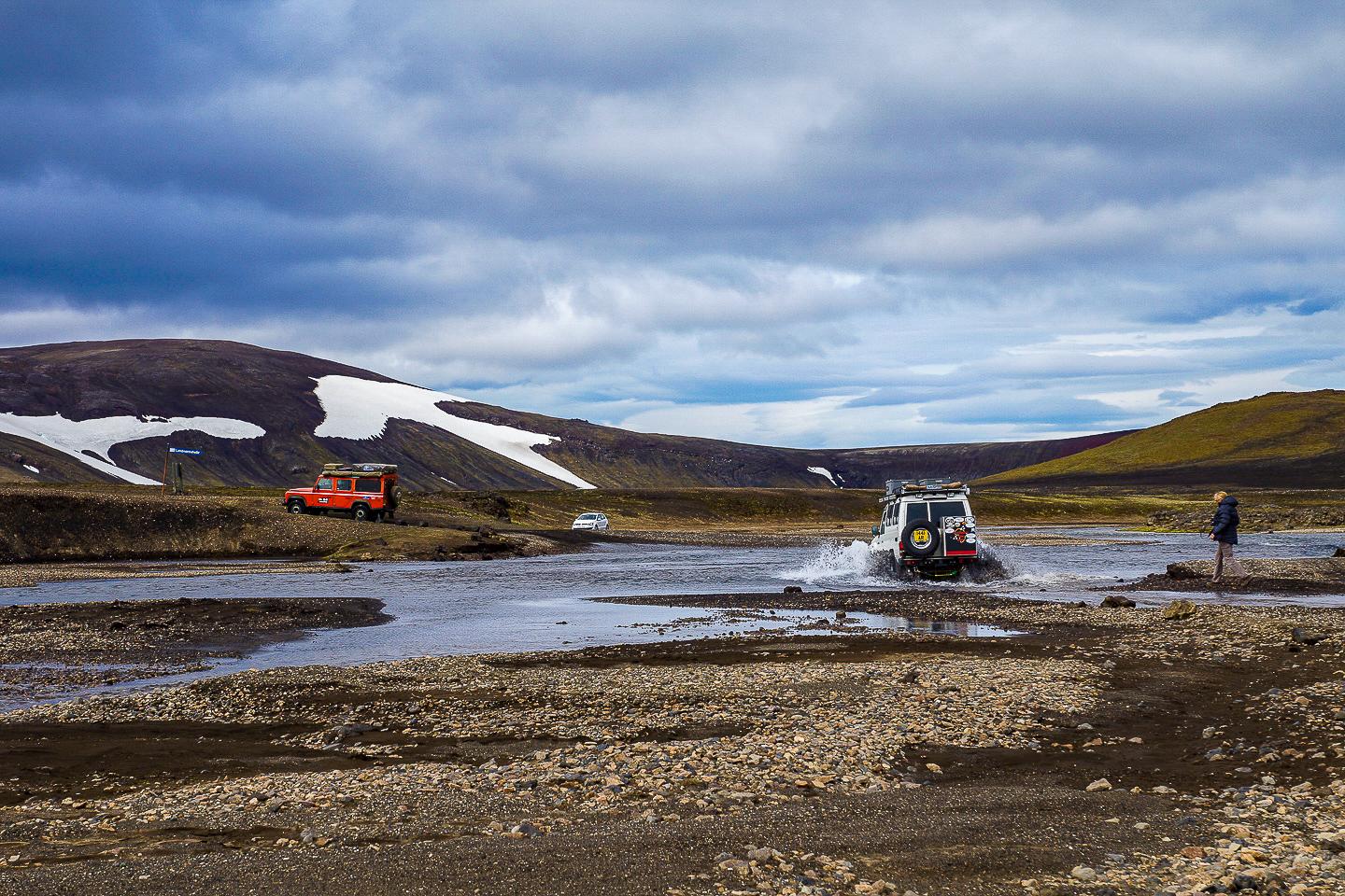
Anyone travelling in Iceland will see them at some point: the big super jeeps and the highly upgraded Land Cruisers and Land Rovers from all over Europe with their air intakes turned upwards, their sandy sheets and their shiny silver expedition boxes, often decorated with exotic-looking stickers from Morocco, Niger, Algeria or Tunisia. A good ride base is essential, but less ostentation is also possible. Important: In the highlands, it's only possible with four-wheel drive and as much ground clearance as possible, so that fording is effortless. This is the term used to describe driving through rivers or deep streams. It is well worth booking a somewhat more expensive model in good time.
The time window for visiting the highlands is narrow. There are 45 designated F-pistes in Iceland and over 60 more or less well-known highland routes. Most of the pistes open at the end of June at the earliest. And then you have just until mid-September. With the first snow, they are already closed again.
The question of route choice remains. In principle, there are only two north/south routes through the Icelandic highlands. One is the Kjölur (F35), the other the Sprengisandur (F26). Both are in the central-western part of Iceland and could hardly be more different. While the Kjölur is no longer an F-route, as no rivers have to be forded there, the Sprengisandur (F26) is something for Icelandic connoisseurs.
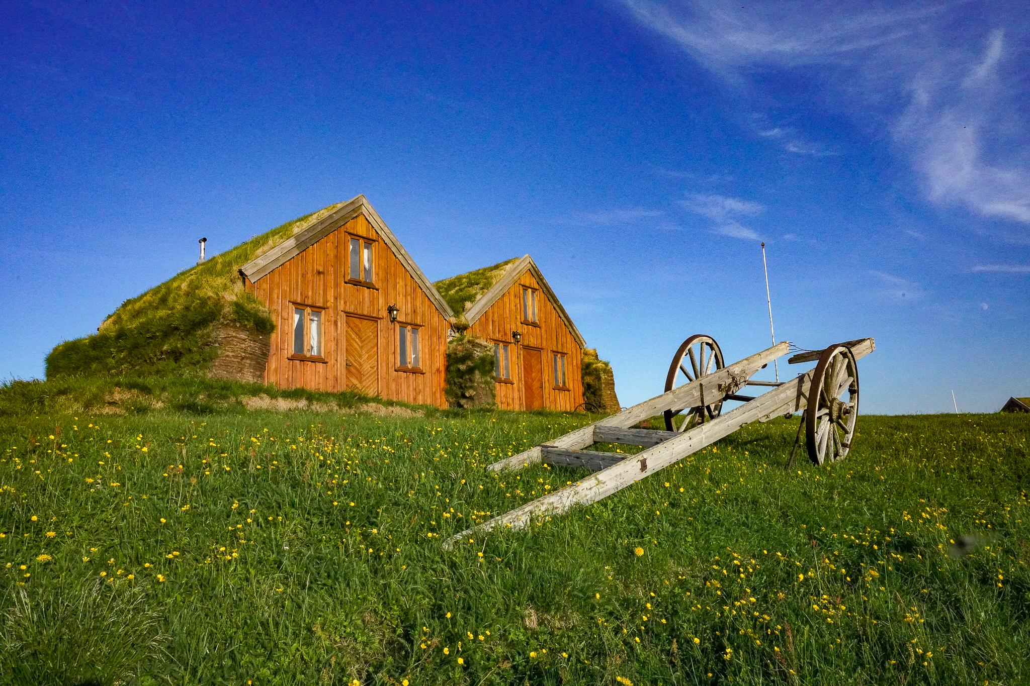
The Kjölur Highland Road F35 leads north from the Gullfoss waterfall through the western highlands between the Hofs and Langjökull glaciers and rejoins the ring road about 20km west of Varmahlíð. The F35 is relatively busy and well-maintained for a highland road. Major rivers no longer need to be forded since several bridges have been completed, and in summer the route is even used by Icelanders as a welcome shortcut from Reykjavik to Akureyri. On the way, there are two worthwhile detours: the volcanic Kerlingarfjöll mountain range is home to Hveradalir, one of the island's large high-temperature areas. Here, there are several options for exploring the area, from hikes lasting several hours to a three-day 50-kilometre hike. The hikes lead through valleys and hills from which steam rises in many places. Here - in contrast to the rest of the highlands - you can also spend the night very feudally at Kerlingarfjöll Mountain Resort.
As you continue along the highland route, you will encounter more geothermal wonders of nature, such as in the Hveravellir area, where hot springs invite you to bathe. Explore the area on horseback for a change: Icelandic horses are well accustomed to the harsh conditions of the area.
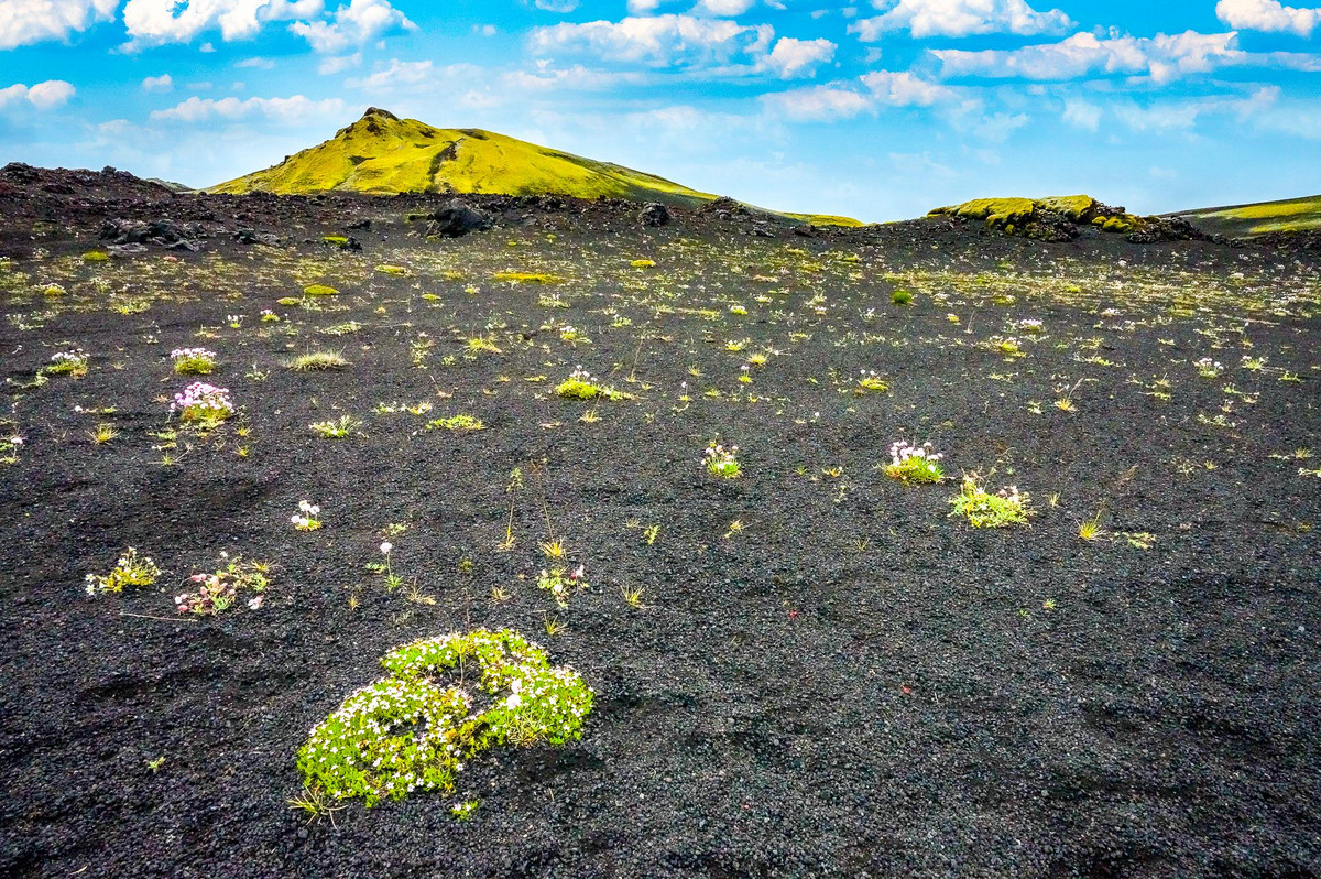
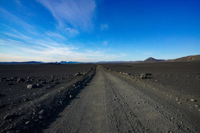
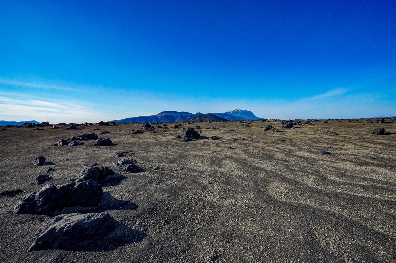
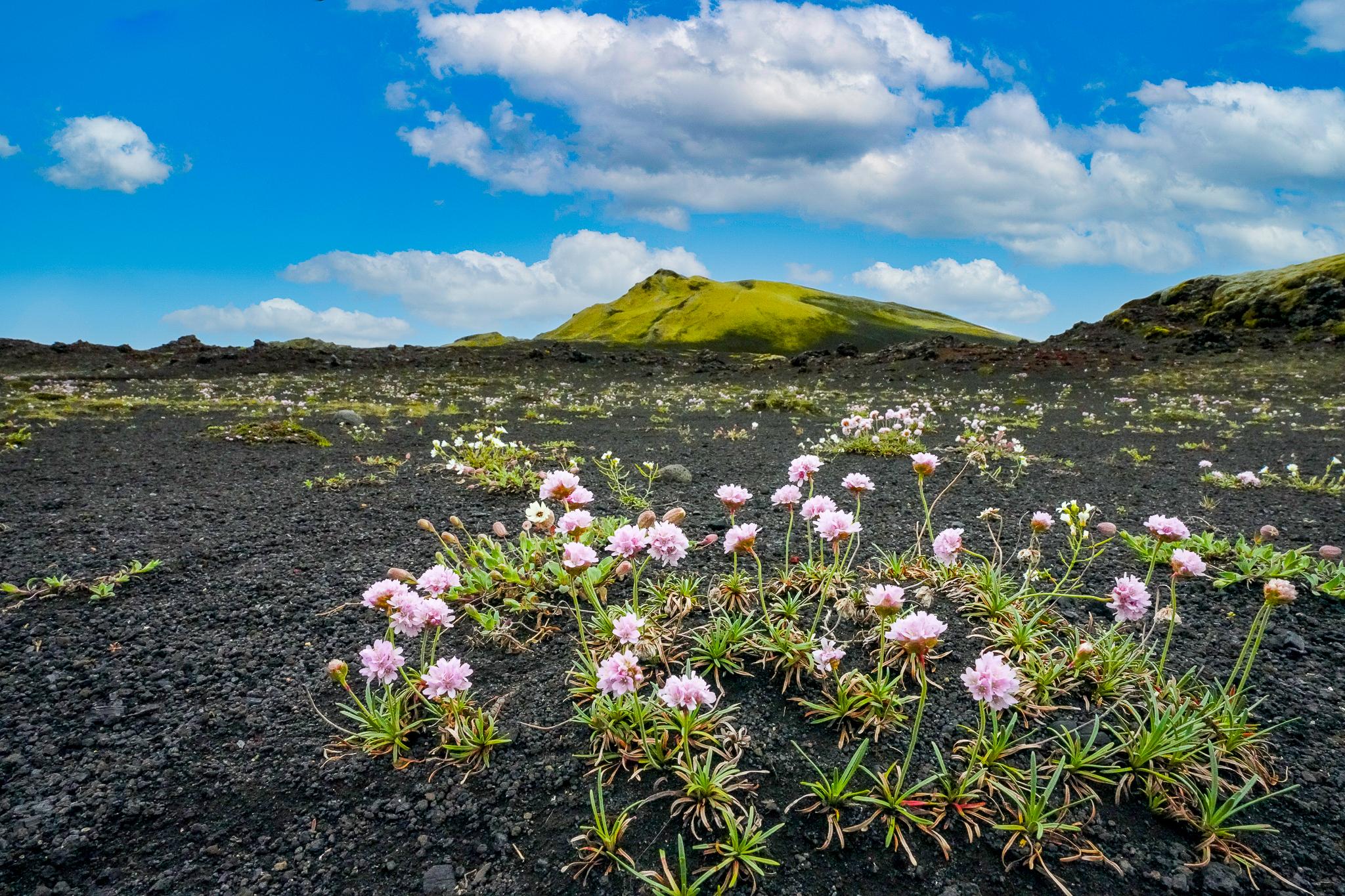
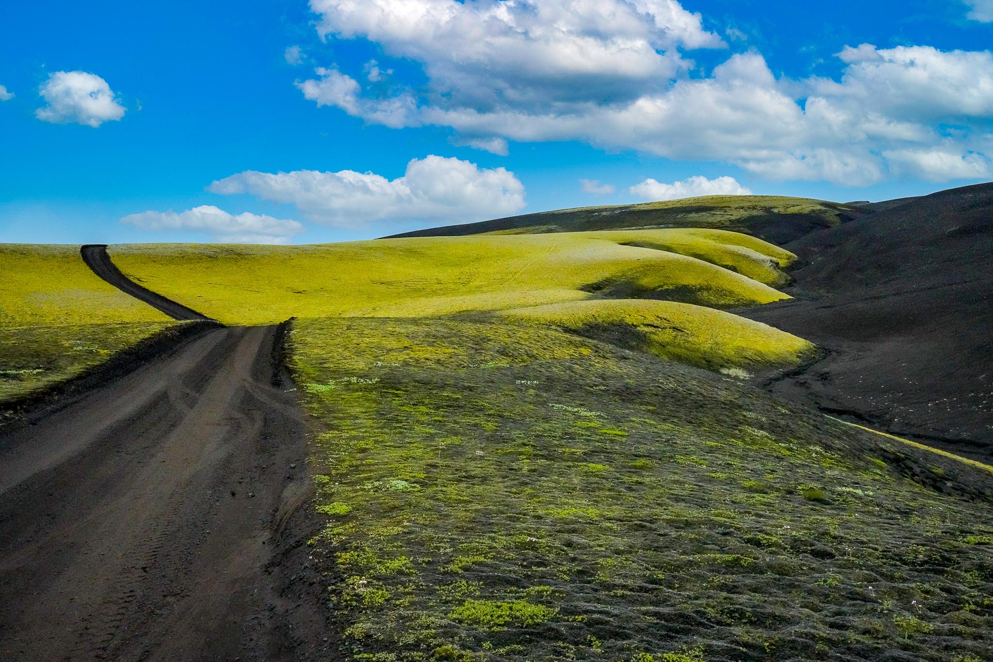
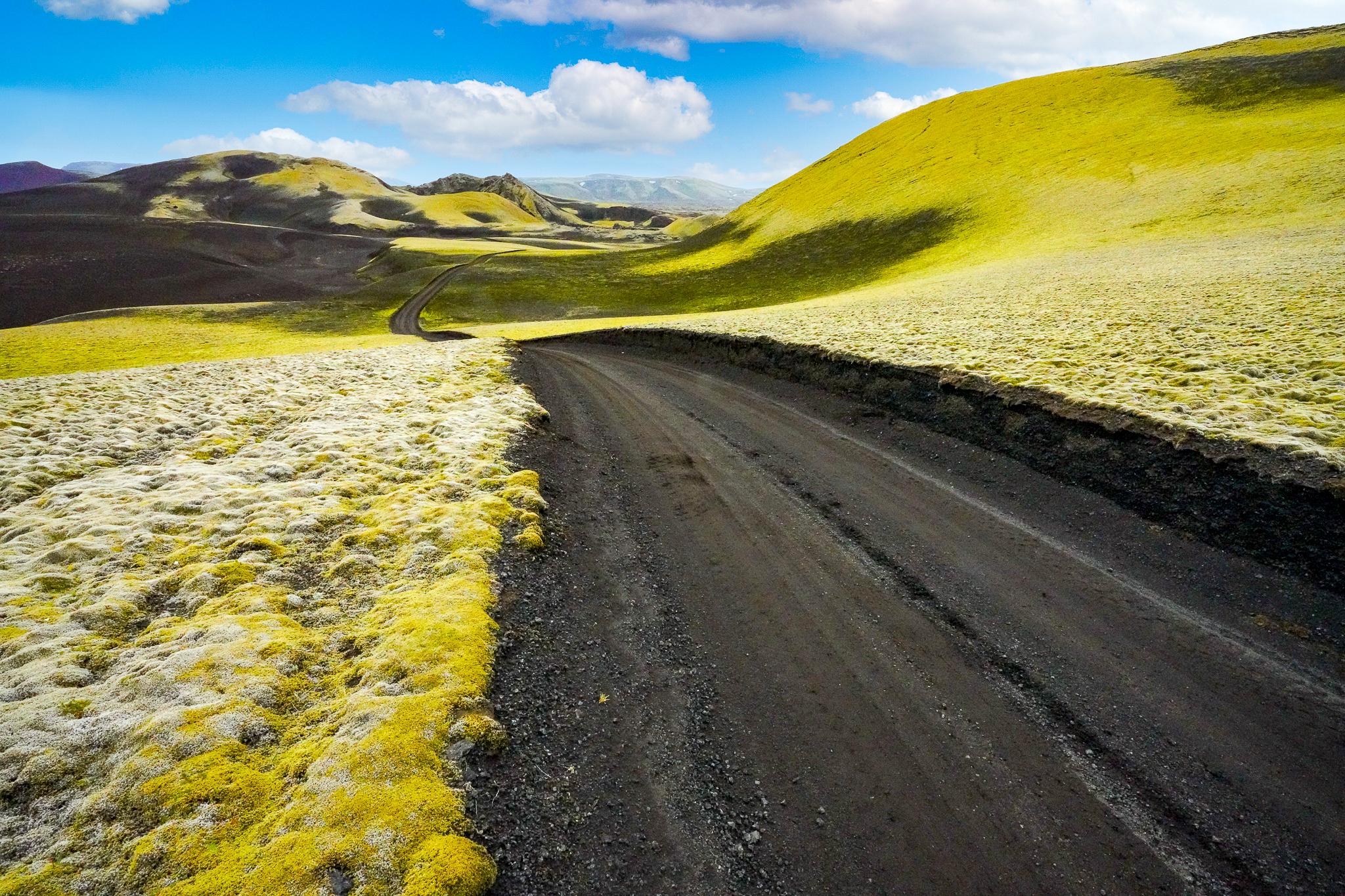
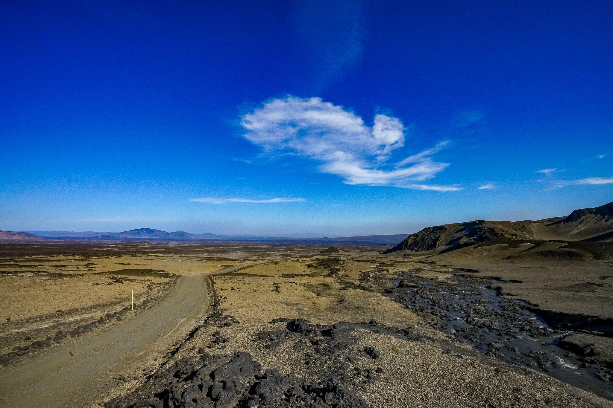
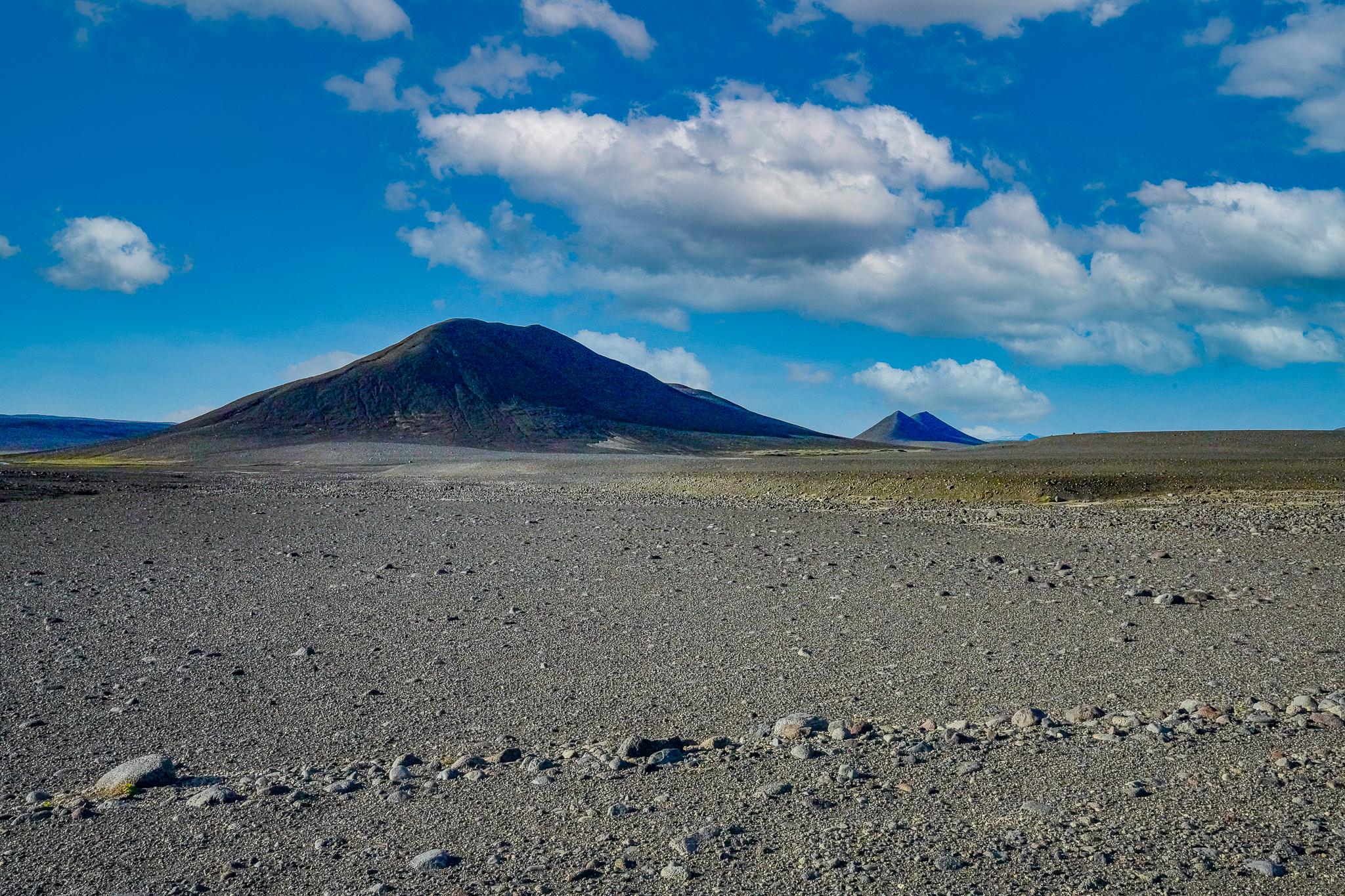
On the technically challenging Sprengisandur track (F26) you drive through the largest desert in Europe. There are many legends and myths surrounding this route. It is said among the locals that there is an eerie mountain queen here who makes passing difficult. There is definitely enough inspiration for fabulous legends here. Finally, you drive through a landscape with unique contrasts: green valleys follow stony deserts with glaciers. On this route, you will sometimes be on the road for hours without meeting other travellers, and you can prove yourself as a skilled driver. Steep, bumpy stretches and river crossings are the order of the day here.
In the south, three other shorter highland trails are worthwhile. The forested nature reserve Þórsmörk, nestled between the glaciers Tindfjallajökull and Eyjafjallajökull, offers numerous opportunities for hiking. Here you will also find camping sites including shopping facilities.
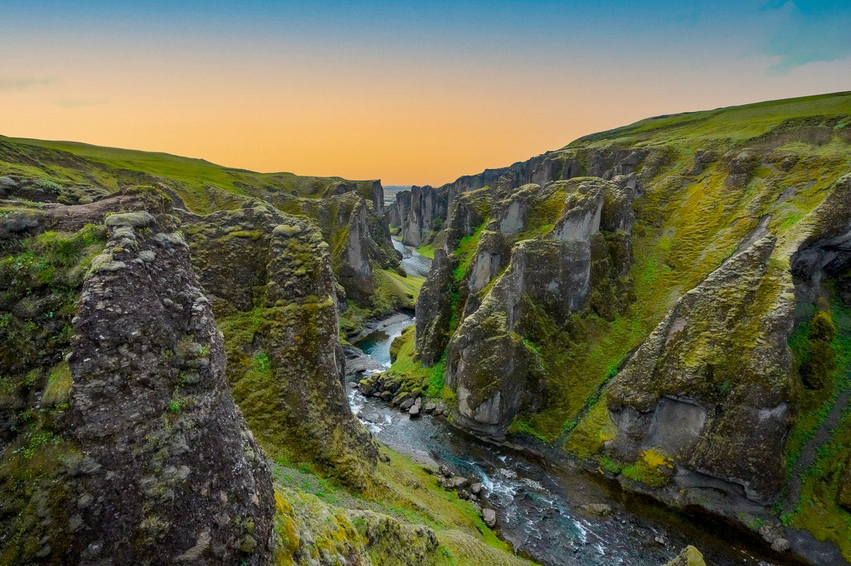
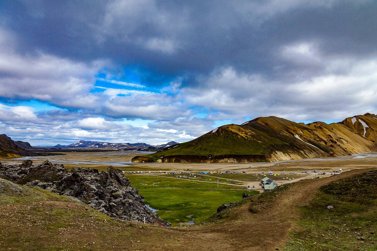
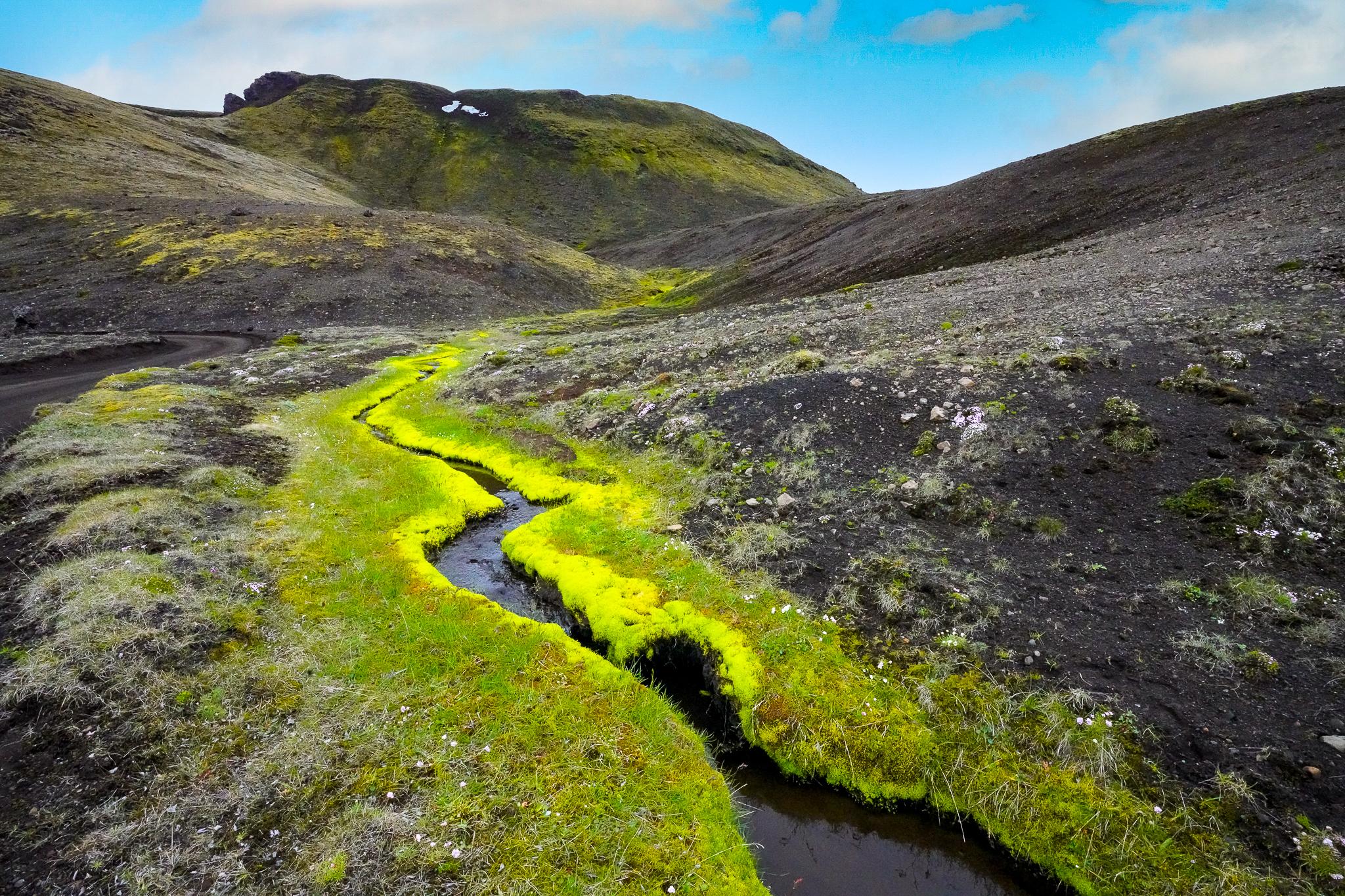
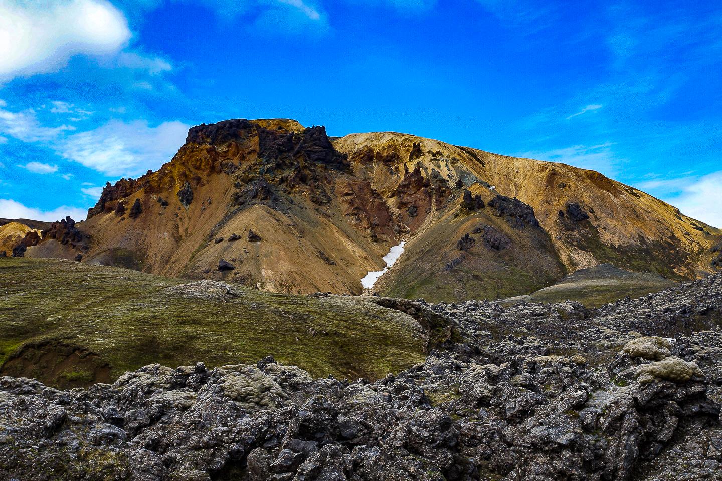
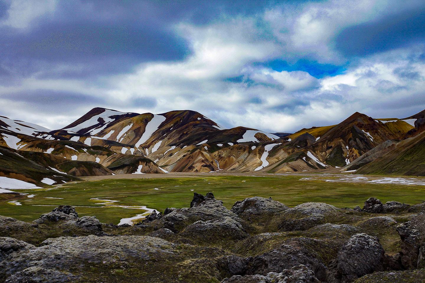
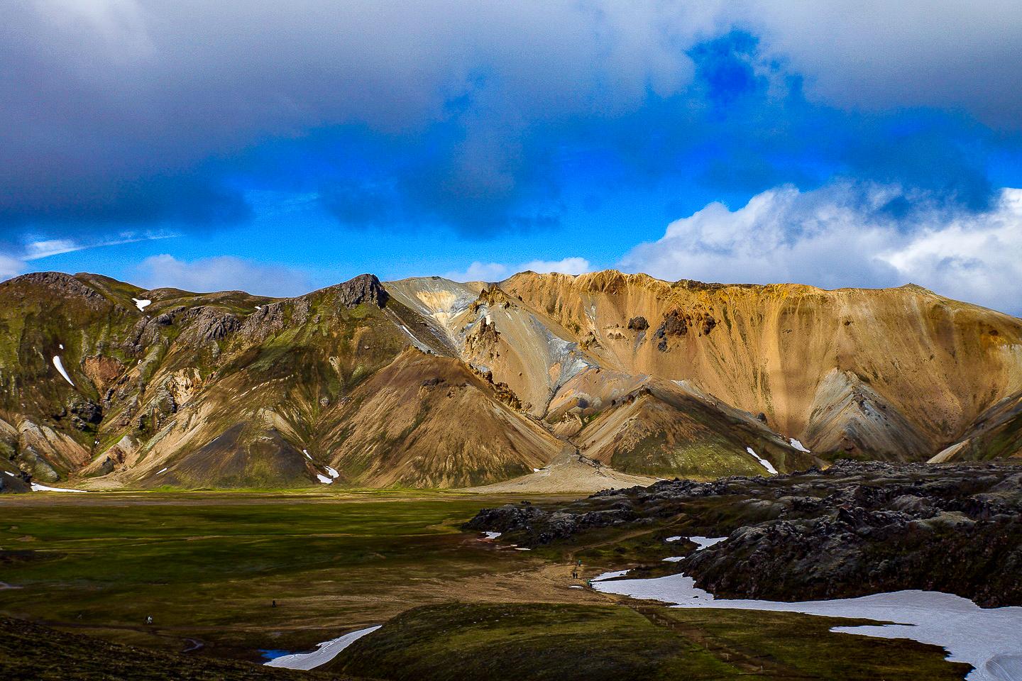
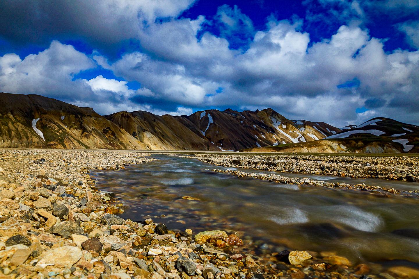
The second worthwhile destination is Landmannalaugar, which is probably one of the most famous hiking areas anywhere in the Icelandic highlands, if not in the whole world. The area is encircled by colourful ryholith mountains: red, black, grey, blue and green colours paint a unique picture. From a few hours' stay to several days, just about anything is possible in Landmannalaugar. There are plenty of hiking opportunities. Be it a hike up one of the surrounding volcanoes with a magnificent view over the barren landscape or the multi-day hike on the Laugavegur Trek. A campsite invites you to stay, and there is a hot spring where you can take a soothing bath in the evening after a strenuous hike.
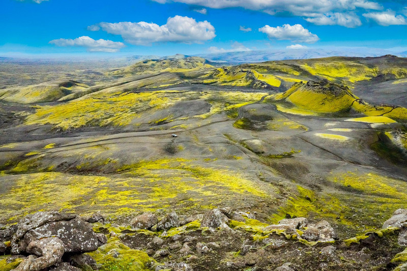
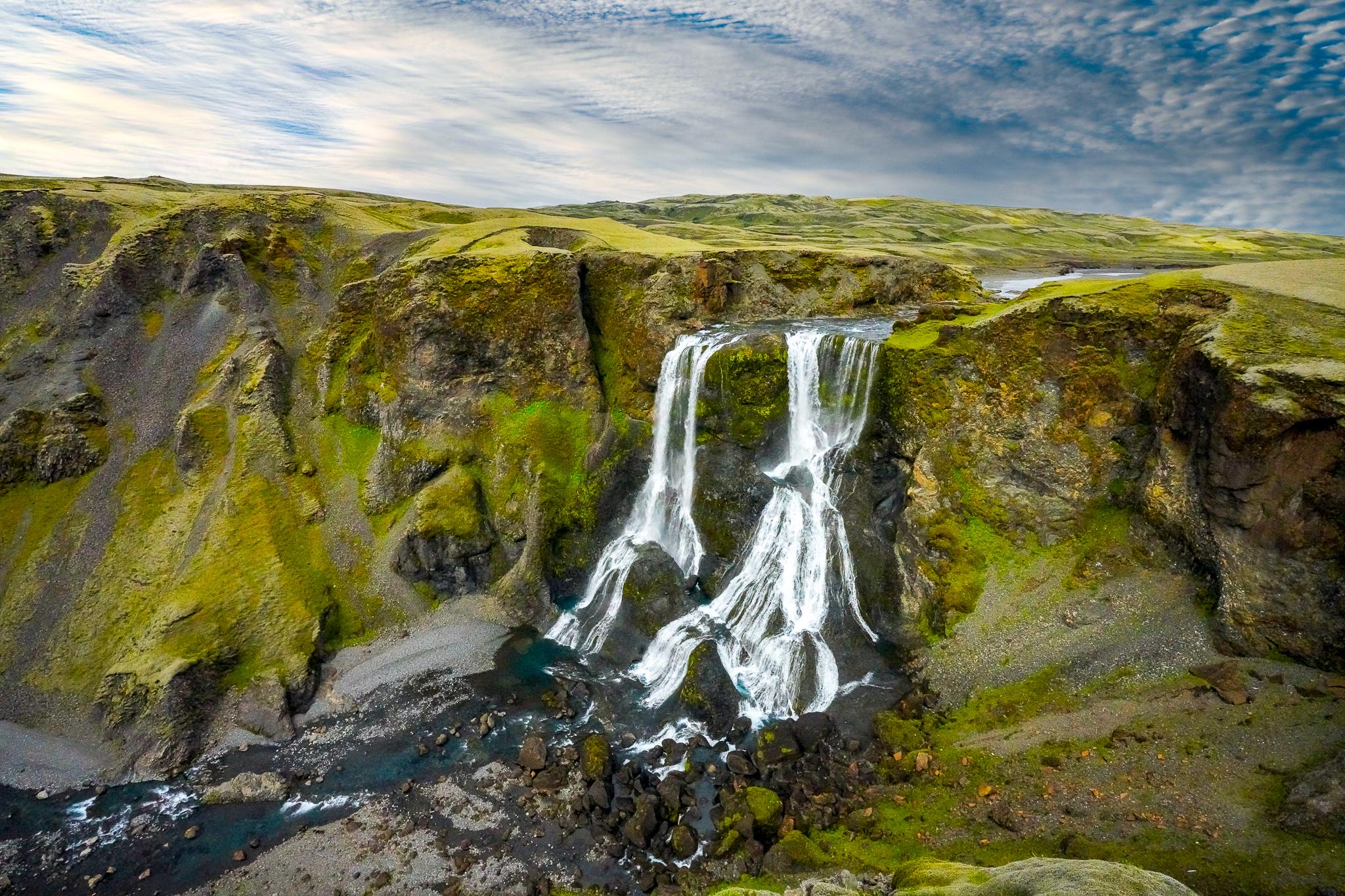
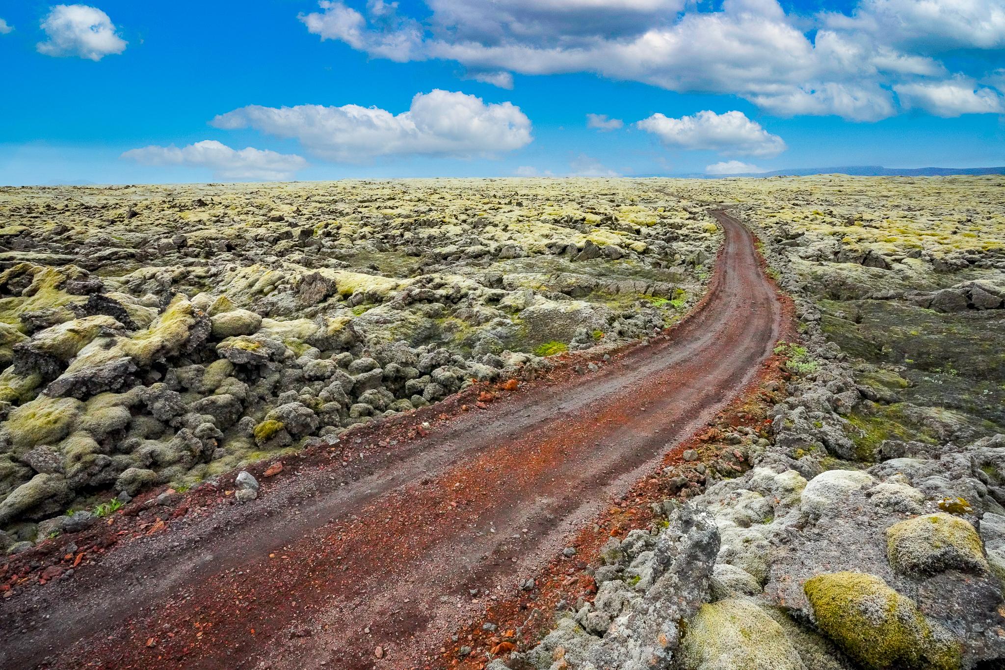
A third and also worthwhile side trip, which can also be planned as a day trip, is the 25 km long Laki crater series, a so-called eruption fissure. Here, too, you need a 4x4 vehicle to get there. Halfway there is a welcome photo stop at the Fagrifoss waterfall, which spills picturesquely over the edge of a cliff. Once in Laki, you can hike from the car park to the top of the mountain of the same name and enjoy the view of the row of craters. A four-wheel drive circuit also takes you past amazing green lava fields and volcanic cones.
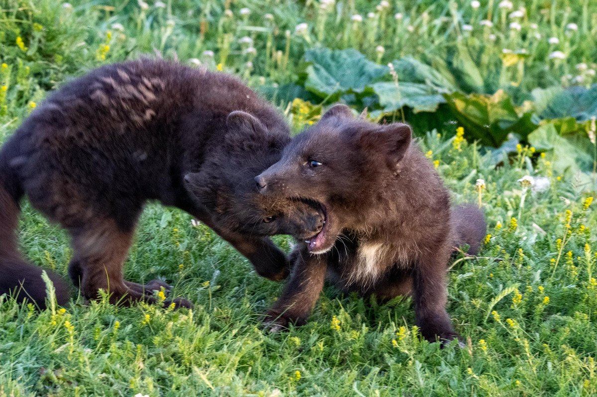
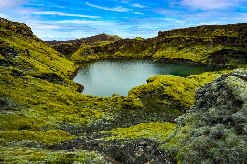
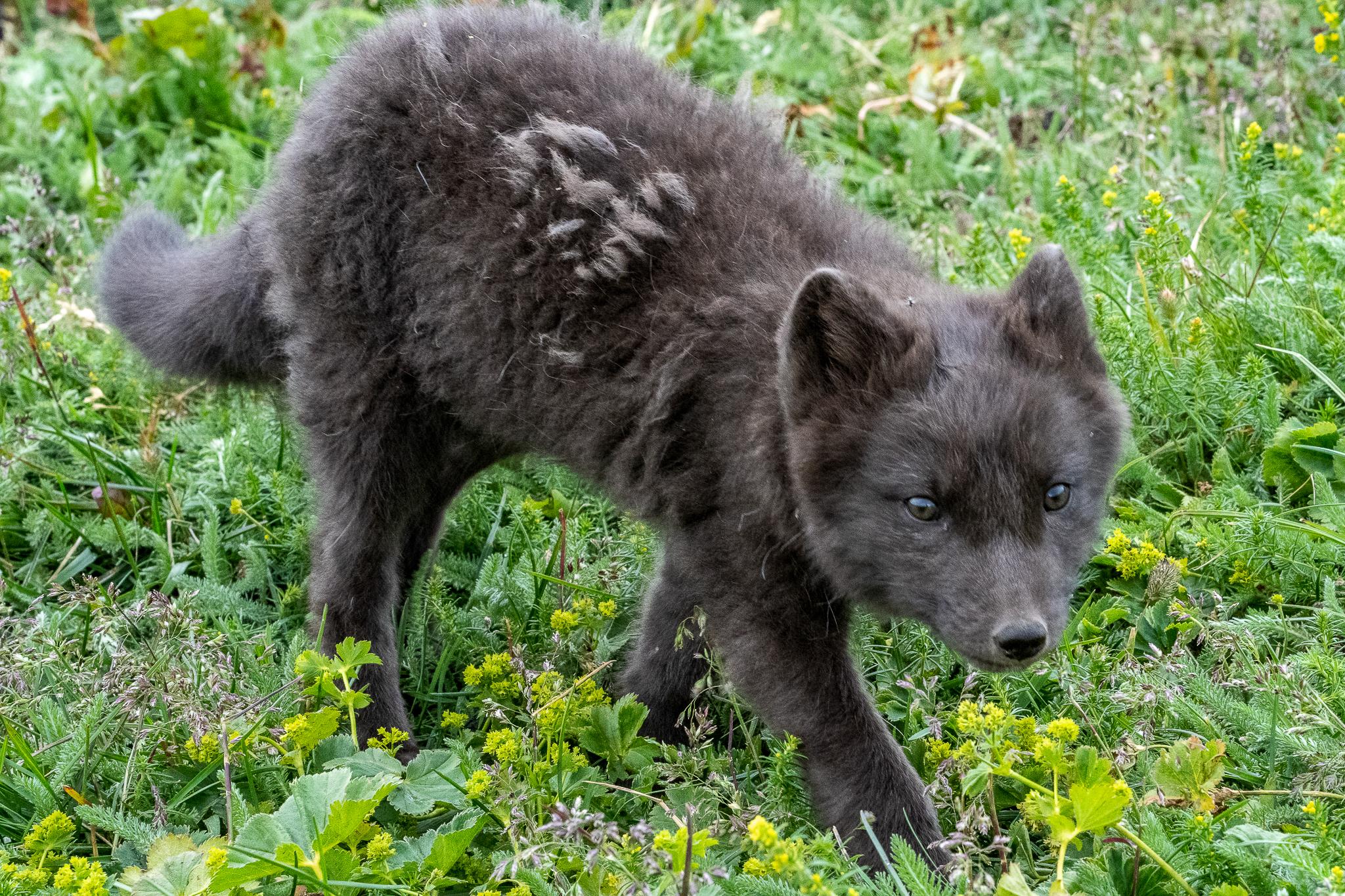
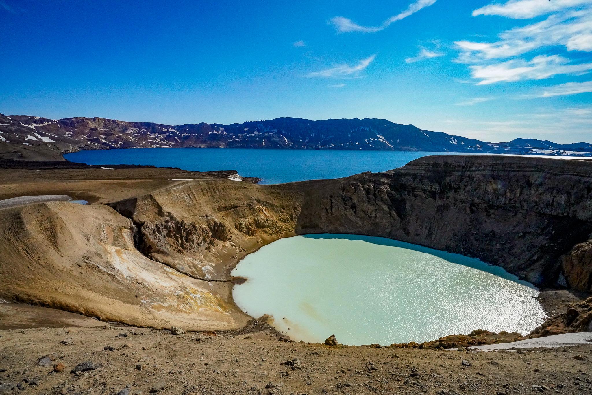
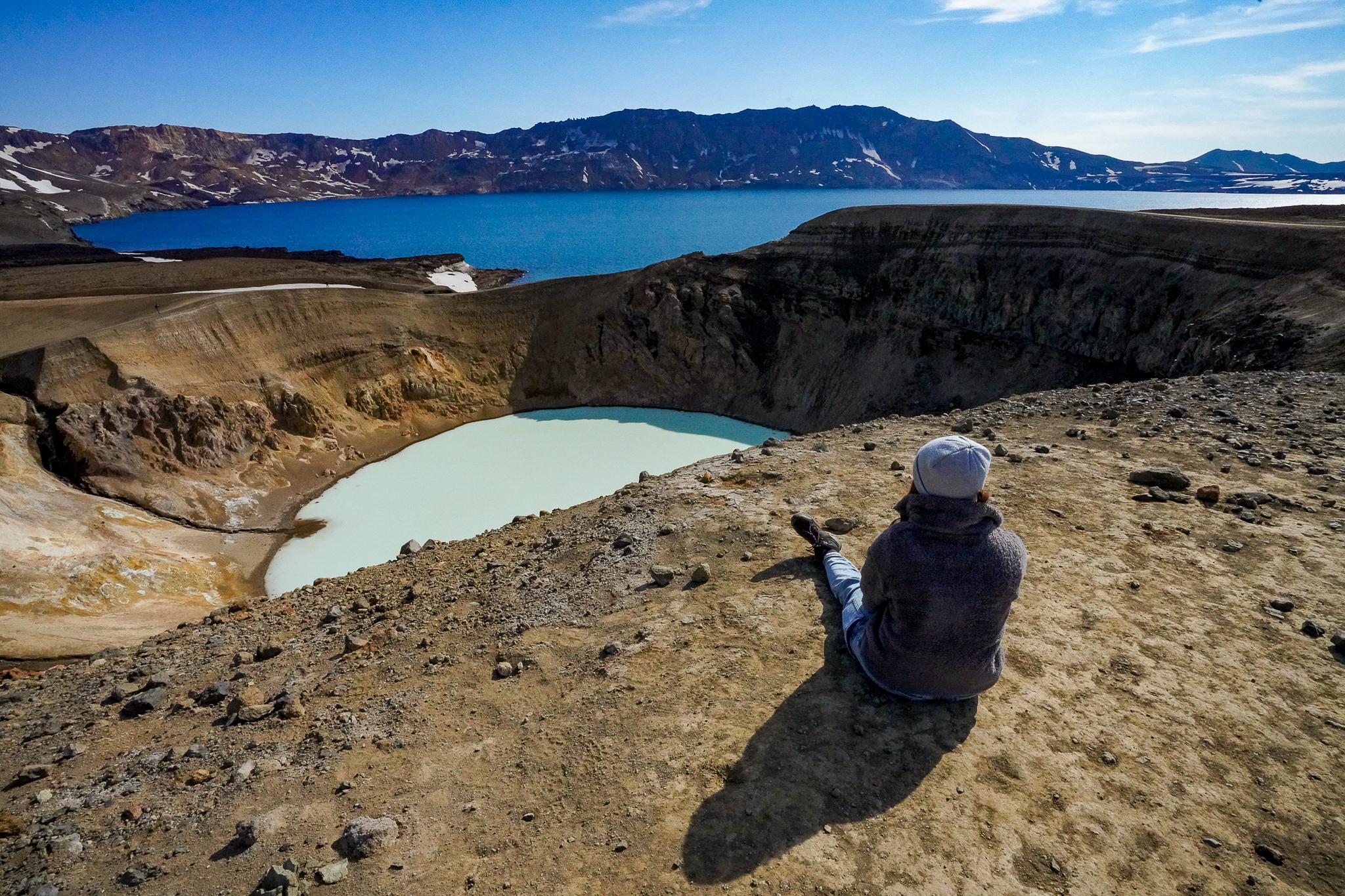
One last highland adventure lies in the north-east of Iceland. The area around Askja is so barren and moonlike that in 1967 Neil Armstrong and Buzz Aldrin already practised here for the upcoming moon landing. The Askja volcano is part of a volcanic system that is 200 km long in total. The crater is more than 10,000 years old, while the adjacent Viti crater was only formed in 1875. It has an impressive diameter of 300 metres, and theoretically you could also bathe in the warm sulphur water. However, the arduous and very steep descent usually discourages visitors from doing so. The hike from the car park to the Viti crater takes about 60 minutes, unless there is still half a metre of old snow, which makes it difficult to walk. The best way to get there is via the F905, where you should stay overnight in Fjalladyrd, the only well-maintained accommodation. Reserve a room in the original replica of the new Torfhaus building. If you've never seen an arctic fox, there's a good chance you'll see the cuddly furry animal in the wild.

This is how you get there:
Mit Edelweiss nonstop ab Zürich
Rent a 4x4 vehicle:
www.sunnycars.ch
How long am I supposed to go:
14 days – combine round trip with highlands
Best travel time:
June to September
Current situation Iceland:
www.safetravel.is
Road conditions:
www.road.is
Highlights:
Viti Crater Lake, Landmannalaugar, Lakikrater.
Accommodation tips:
kerlingarfjoll.is and fjalladyrd.is
More info:
www.visiticeland.com
Impressions


Realised by Michael Bachmann
Further travel pictures under www.kissed-by-nature.com