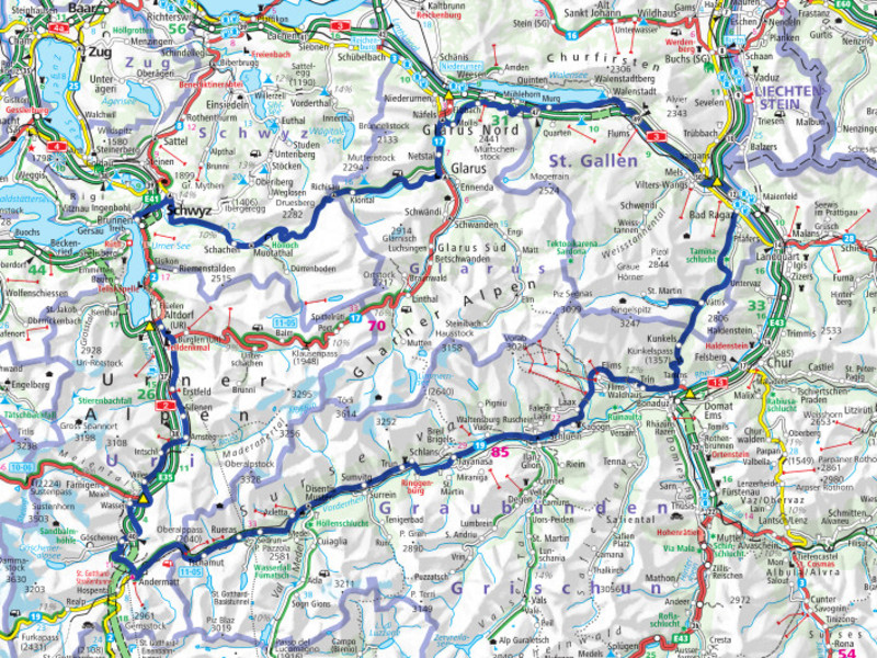
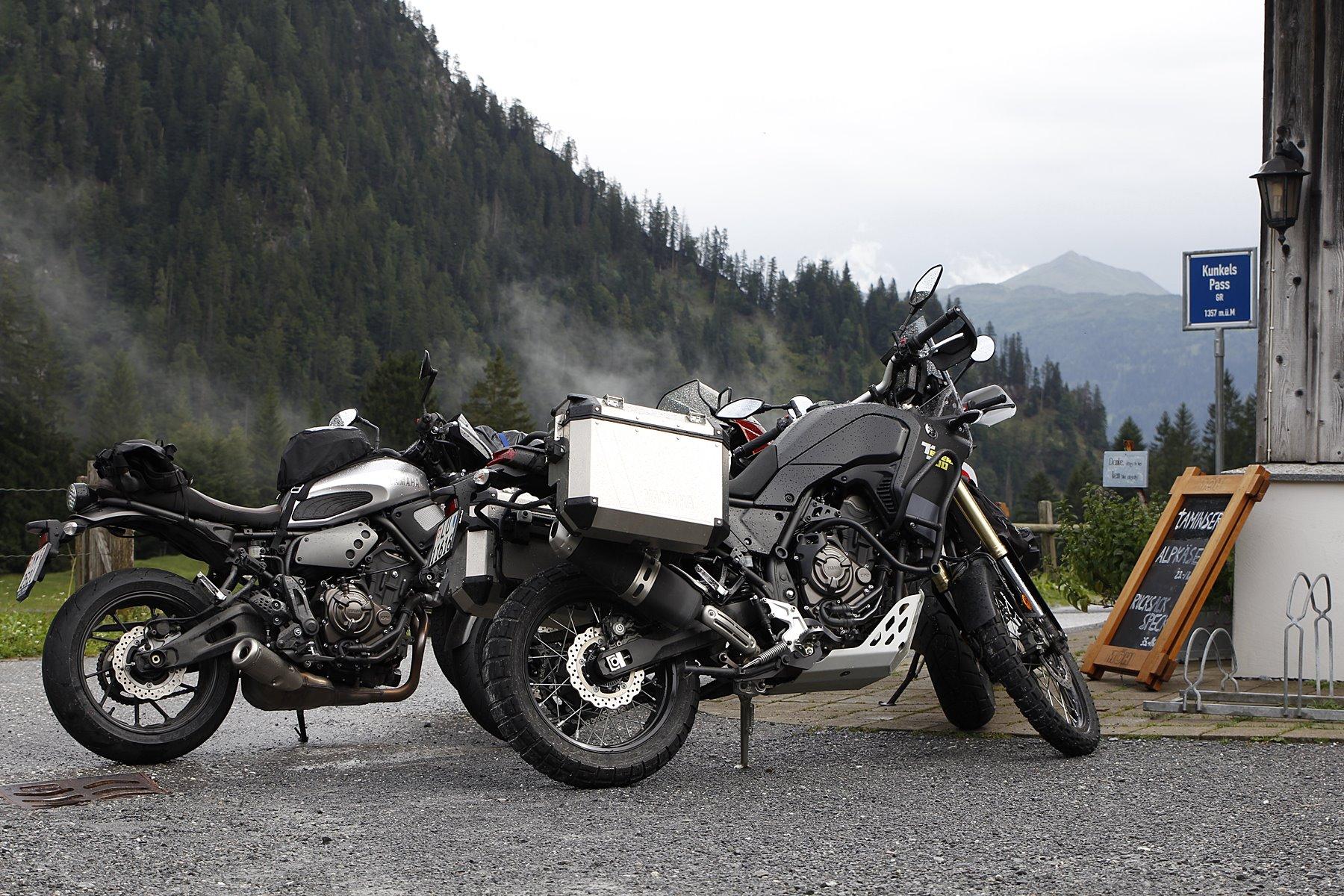
Maybe you've heard of the Kunkel Pass? We tell you why it and other sideshows are worth a bike ride …
What lies between Bad Ragaz SG and Tamins GR? Correct: Chur. At least in the valley on the country road and the highway. Another answer is: the Kunkels Pass, which connects Vättis SG with Tamins. It is one of those crossings that you may have heard about, but have never driven over yourself, because ... Yes, why actually? The Kunkels is basically easily accessible. But the principle existing driving ban could be a reason here. You can see it from far away, and if you don't already know more about it, you might be persuaded to turn around as soon as you see it.
But here we have another example of why it is always worth paying attention to the fine print as well. Directly below the ban, there is an exception for agricultural and forestry drives and another notice that from the restaurant "Überuf" the maximum width is 2.30 meters and the maximum height is 2.90 meters. One more step below follows another sign. To read this, one must definitely stop or get off. Here you learn that you can easily buy a day permit: To do this, you have to send an SMS with the following content "epark 186 [license plate number] [amount]" to the number 9000. The permit costs 10 francs for motorcycles, 20 francs for vehicles up to 3.5 tons and 40 francs for vehicles over 3.5 tons (only if you are also on the road with other motor vehicles). The permit entitles you to one ascent and one descent within five days. So nothing would stand in the way of an overnight stay at the top of the pass (1357 m above sea level).
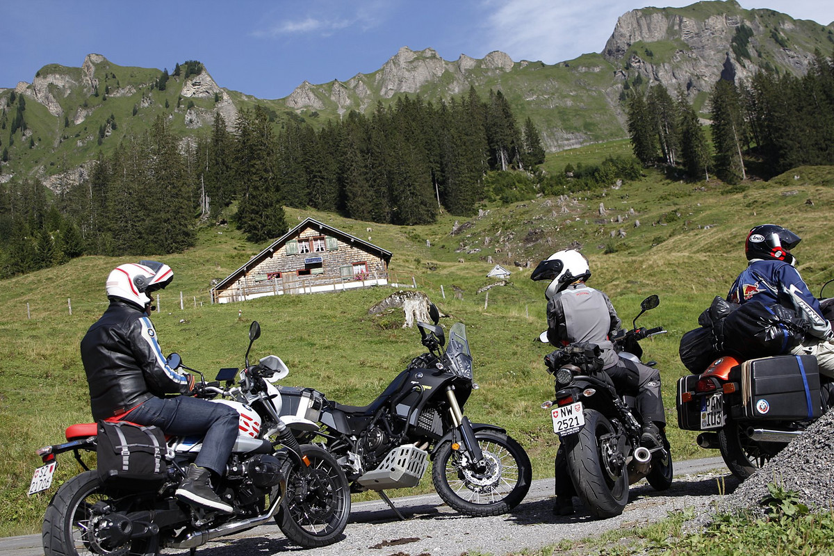
The road over the Kunkels Pass is a single-lane secondary road on which larger vehicles can cross only at the passing places. Most of it is asphalted. However, a shorter section on the southern ramp is, and this is considered one of the highlights, graveled - an even shorter section even rougher than usual on dirt roads. Nevertheless, the entire pass can be easily ridden on any motorcycle.
Formation of the Alps
The Kunkels Pass is only about 13 kilometers long in total. But you drive here leisurely, so that you are on the road for a while. In addition, the beautiful and impressive nature can be enjoyed even more. After all, we are in the middle of the Tectonic Arena Sardona, which was included in the World Heritage List by Unesco in 2008. In this area, "the diverse and original phenomena of mountain formation can be experienced in nature in a vivid and globally unique way," teaches us a plaque at the top of the pass (www.unesco-sardona.ch). Speaking of which: Up here, Marlis and Hansi Derungs extend a warm welcome to every guest at the Überuf mountain inn - whether motorcyclist, hiker or cyclist.
Calfeisen Valley, Plattenkreuz and Upper Lake
Of course, not only the Kunkels Pass is worth exploring on this tour around the Glarus Alps, which is about 280 kilometers long in total, but also two or three other lesser-known routes. For example, the Calfeisen Valley, a side valley of the Tamina Valley, which begins in Vättis. It leads to the reservoir called Gigerwaldsee or even further to the former Walser settlement of St. Martin at 1350 m above sea level. There are only seven buildings here, but among them is a restaurant that is open from May to the end of October. Another gem among the touring destinations is the Obersee in the valley of the same name, about 7.5 kilometers above Näfels. At the green-blue water at 983 m above sea level you can enjoy idyllic scenery at the foot of the Glarus Pre-Alps. On the way there, a stop at the Plattenkreuz, about 3 kilometers from Näfels, is worthwhile for those who are free from giddiness and have a talent for scrambling.


LET THE SOUL DANGLE
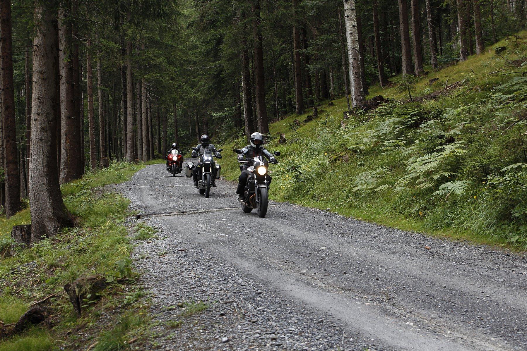
Various stops - There are motorcycle tours that unearth a lot of adrenaline. This one serves more to let the soul dangle. For example, on the Kunkels Pass (pictures above and right - gravel road), at the Plattenkreuz above Näfels (although here the climb is not quite easy), from where you can enjoy a magnificent view over the valley and in a northeasterly direction all the way to Lake Walen. It is also idyllic above Glarus on the alternative and single-track side route to the Klöntalersee (below).
THE LARGEST IN THE CANTON
Gigerwaldsee - Above Vättis (Pfäfers), the Tamina has been dammed in the Gigerwaldsee since completion of the dam in 1976. Today it is the largest lake located only on St. Gallen cantonal territory. At the lake you can enjoy an impressive panorama.
SEE EXPERIENCE TAKE ALONG
Brunnen - Central meeting point for further tours towards the Alps, e.g. Café Belmondo, with bike parking directly opposite.
Obersee / Plattenkreuz - The Obersee above Näfels invites you to take a break. In the Berghotel Obersee you can enjoy Glarus cuisine. berghotel-obersee.ch
The best view of Näfels is from the Plattenkreuz.
Bad Ragaz - The Tamina Gorge means: natural spectacle and on hot summer days a welcome cooling. altes-bad-pfaefers.ch
Gigerwaldsee / St. Martin Photo stop at the dam wall of Gigerwaldsee, stop in historic St. Martin in the Mesmerhaus built in 1588. www.sanktmartin.info
Kunkels Pass - Unesco World Heritage. kunkelspass.ch
Text: Dimitri Hüppi — Pictures: D. Hüppi, Hansi Derungs, Harald Beiner
www.moto.ch