Avoid highway traffic jams! Instead take the narrow asphalt ribbon which winds its way through mountain farming villages and lush alpine meadows: The Ächerlipass.
Gotthard Pass, St. Bernhard, San Bernardino ... Trade routes over the main Alpine ridge have been documented since the Bronze Age. Switzerland also had economically important Alpine crossings to offer early on. Today, the passes are heavily frequented not only because of their importance for goods traffic. During the holiday season, there are also numerous tourists from all over the world. The TÖFF editorial team has therefore set out to look for some lesser known Swiss passports, which we would like to present in the next issues. But even if a passport is small and unknown, this does not mean (as we will now see in the example of the Ächerlipass) that it was not of enormous national, even existential importance at the time. Well, admittedly, as a motorbike driver you don't think much about it at first. After all, we are all more or less driven into the mountains by the same thing: as many curves as possible and the great landscape.
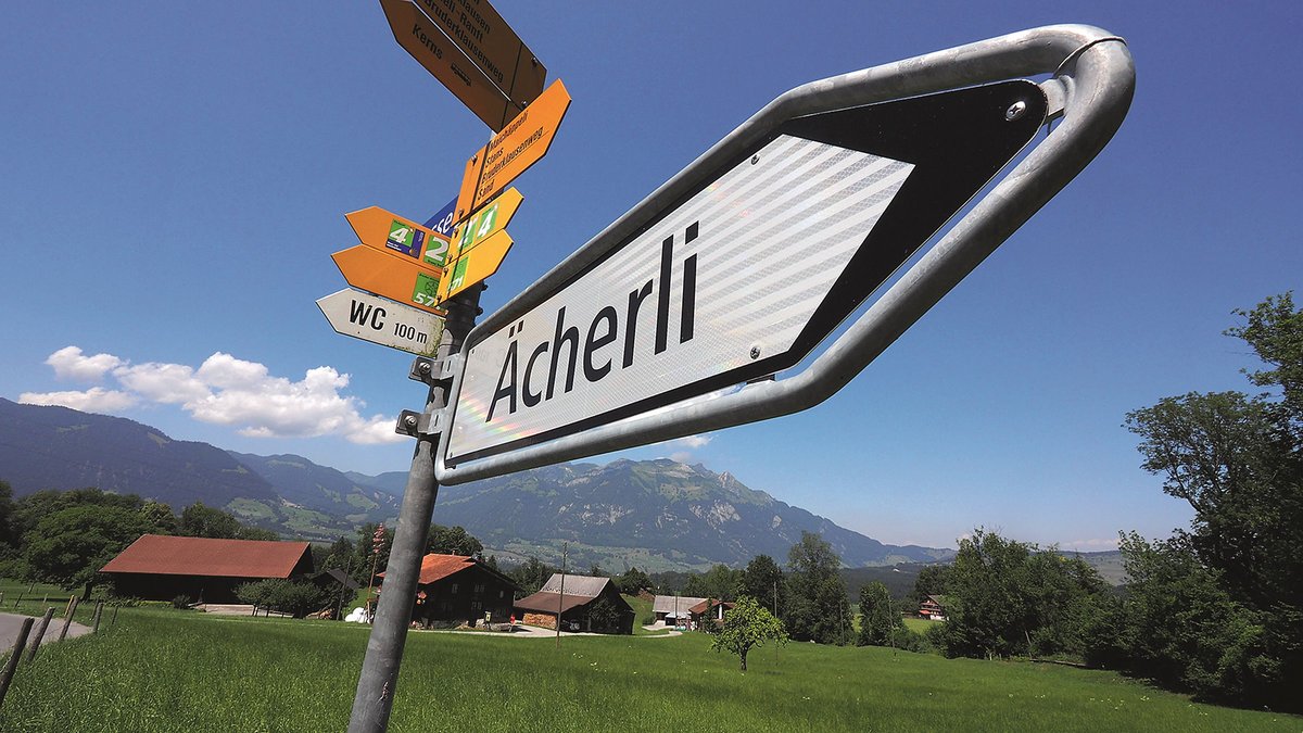
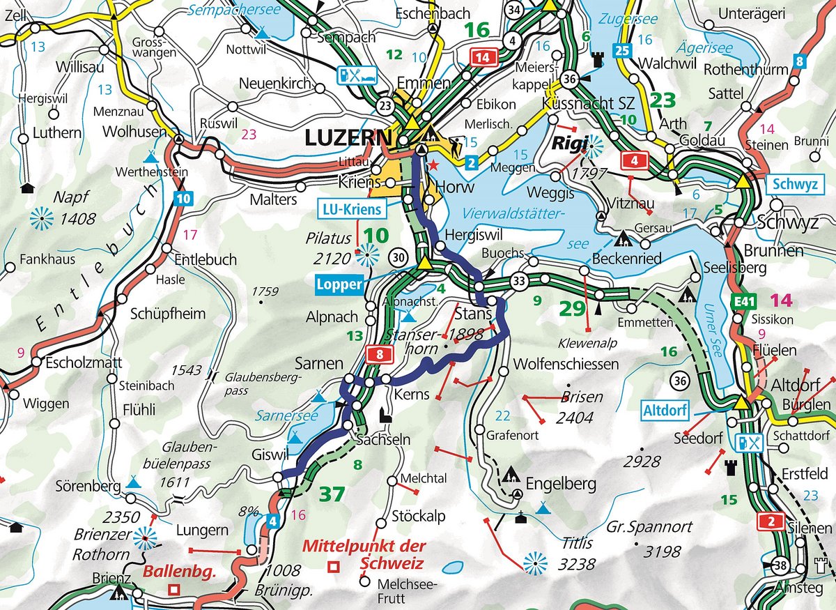
The Ächerlipass offers even more. With "only" 1458 metres in height, it is indeed an unimportant connecting pass in Central Switzerland. Its route leads from Sand bei Kerns to Dallenwil and connects the two half cantons of Nid- and Obwalden. The asphalted road has a total length of around 20 kilometres and gradients of up to 16 percent. With the exception of alternative points, it is usually only PW wide, i.e. quite narrow. Approximately eighty percent of the western approach from Kerns is in the forest, so there are only a few ingenious vantage points offering a view of Lake Sarnen. Only from the top of the pass is the distant view unique in good weather: the mountain massifs Pilatus (2137 m), Rigi (1797 m), Stanserhorn (1898 m), Buochserhorn (1806 m) and the snow-covered Titlis (3238 m) can be seen. The view remains uninterrupted, as the east descent to Dallenwil is wonderfully open in contrast to the wooded approach from Kerns. It is also steeper and many small hairpin bends demand man and machine. Therefore the Ächerli is not to be recommended to insecure beginners with heavy machines.
The small connecting road gained national importance on a historic Sunday in 1798. Napoleon invaded Switzerland, was stopped at the Stanserhorn massif and did not find his way to Nidwalden. But suddenly some of his units arrived over the small Ächerlipass. As a result, French troops killed over 400 Nidwaldens during the attack on 9 September. And according to legend, an Obwaldner is said to have betrayed the way to Nidwalden to the French via Gross- and Chli-Ächerli. For a very long time this story caused bad blood between the two half cantons. This even became noticeable when a Berlin conceptual artist in 2013 annexed a square metre of land to the Ächerlipass without further ado, called it "Arcadia" and boldly announced that Switzerland no longer had state power over this spot.

Back never, genius always on...
Regardless of whether you approach Ächerli from the west or from the east, there are many attractive routes to follow: the exquisite Ächerlipass experience can be combined with the famous Furka, Grimsel and Susten royal rounds, for example. Those who prefer to continue on through the offside will also have a lot of fun with the round over the Glaubenbüelen and Glaubenberg passes.
Rural impressions
Central Switzerland - The architectural design of rural Central Switzerland is usually a log building built predominantly of wood. The houses were often built on a square ground plan and divided into two halves by a log wall across the ridge line.
The city, the lake, the mountains
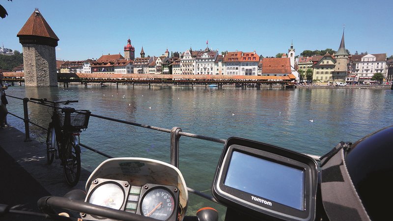
Lucerne - Some say that Lake Lucerne is the most beautiful lake in Switzerland. The fact is, Lucerne with its historic sites is worth a trip and the ideal start or end of this tour tip.
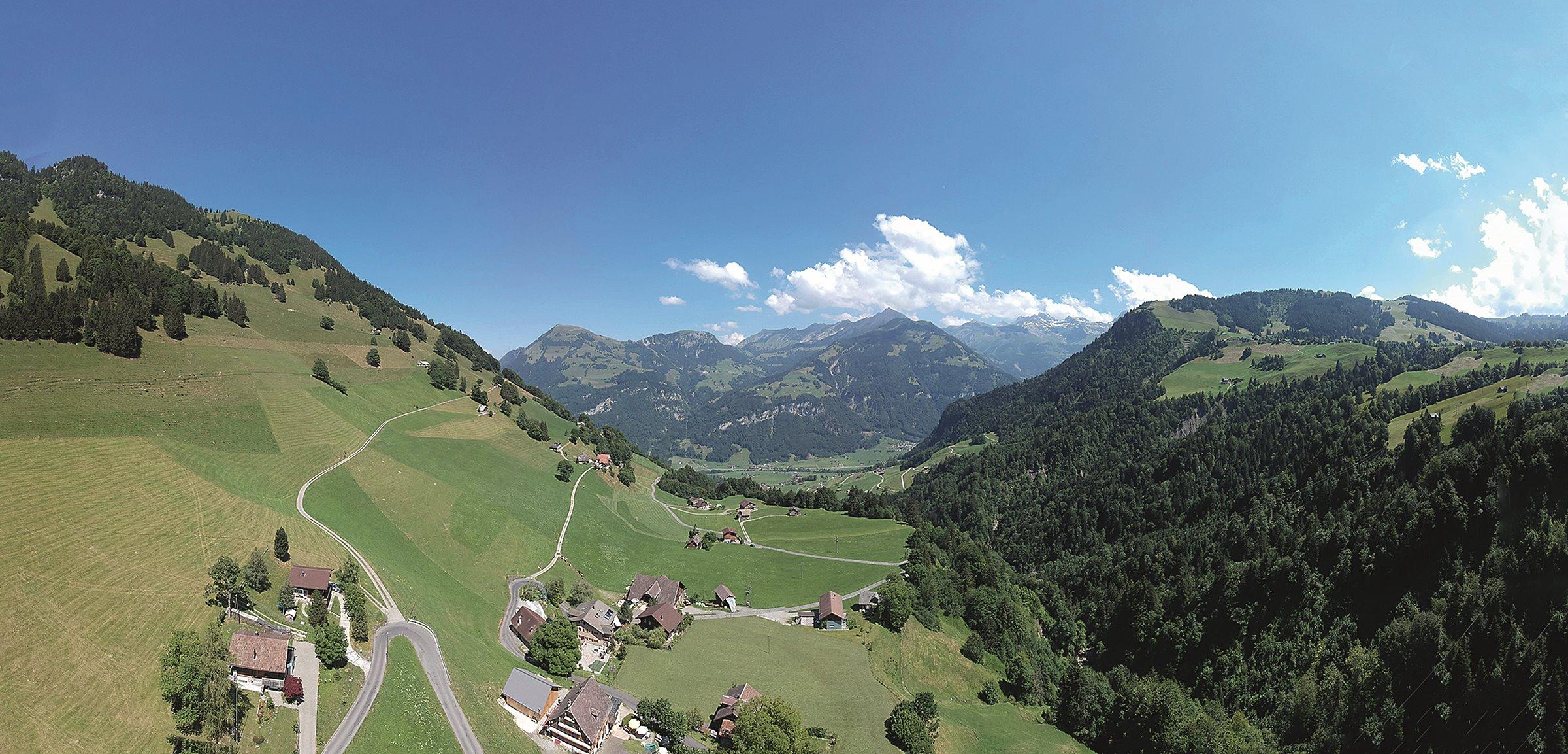
Valley of mountain farms
Ächerlipass - connection of the cantons of Obwalden (OW) and Nidwalden (NW). The Ostrampe offers wonderful views of the valley, Lake Lucerne, Schwalmis, Bristen and the Urirotstock area. The western ramp mostly leads through woodland.


Text: Michael Kutschke
www.moto.ch
Pictures: Kutschke