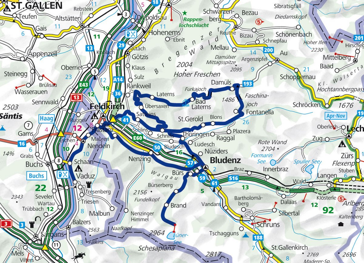
On this almost 170 km long day tour we swing through idyllic valleys and climb rough heights in the Austrian Vorarlberg.
We start our tour in the Principality of Liechtenstein - in the Ländle, as the inhabitants affectionately call their homeland. As a greeting one simply says "hoi" to oneself here - as it is also common in Switzerland. The difference, however, is that this greeting is addressed to strangers with whom you are per them ... Vaduz, the capital of the principality, serves us with its "Städtle" with its beautiful pedestrian zone as a starting point. Vaduz can easily be reached from Switzerland from Sevelen (country road or motorway exit).
View in direction Bregenzerwald
From Vaduz it is only 12 kilometres to Feldkirch. We can cross the border here without stopping. Opposite the Raiffeisenbank we bend sharply to the right to avoid any traffic lights in Feldkirch. Thus it goes by some speed-30-living zones over smallest roads direction Frastanz. We gain altitude for the first time and views of the Rhine Valley/Walgau motorway A 14 running through the valley and the Bregenzerwald forest beginning behind it. We will also cut this one, but before we head for the Brandnertal...
Its entrance is in Bludenz, which can also be reached via the main road 190, if you want to do without the initial Feldkirch outdoor living quarters and the first bends before Nenzing. Of course also via the motorway, for which you need the Austrian vignette (10-day sticker for motorbike: 5.10 euros). The idyllic Brandnertal valley begins with well-developed curves that widen slightly over time. After ten kilometres we reach the ski and holiday resort of Brand.
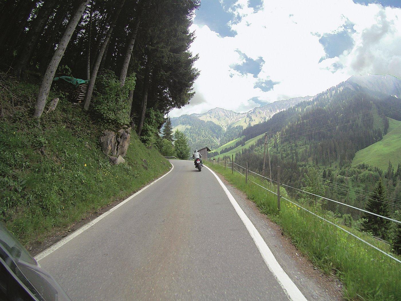
We stroll by motorbike through the village and then take the last six kilometres of the valley with us. Now it gets narrower and steeper, the landscape more alpine and rugged. At 1566 m. above sea level we reach the valley station of the Lünerseebahn, which alternatively leads to the hiking trail "Böser Tritt" to the Douglas hut and the Lünersee (1970 m.) (outward and return journey: 11.80 Euro).
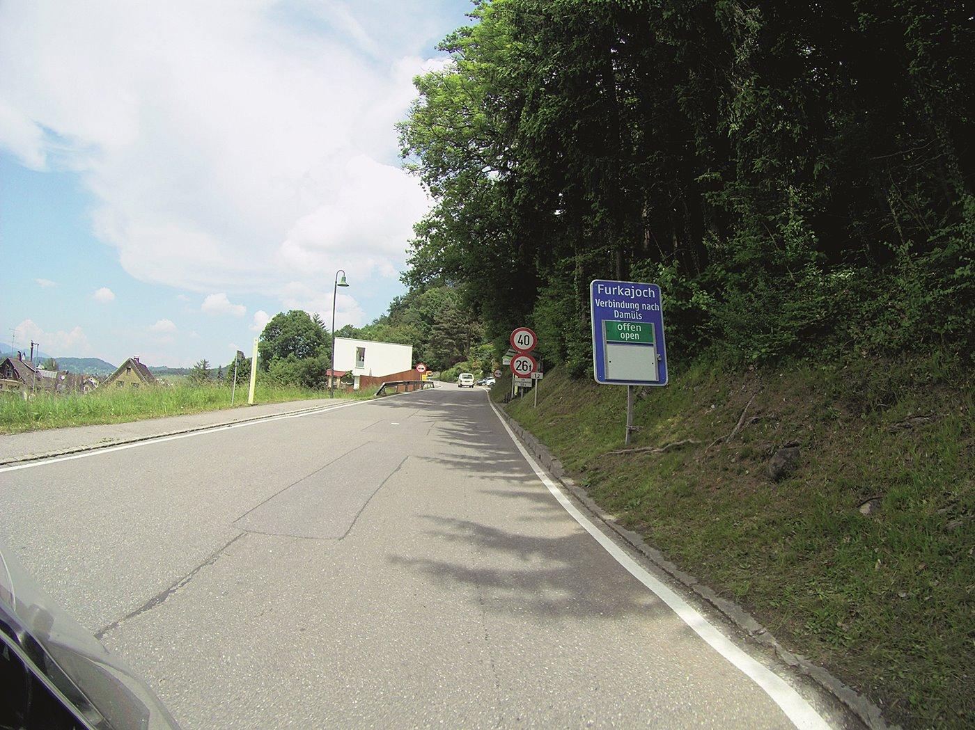
We turn around and race down the valley again to head for Rankweil from Bludenz via Thuringia (yes, the village has the same name as the German federal state), from where the big ascent to the Furkajoch Pass (not to be confused with the Swiss Furka Pass) begins. The ride through the Laternsertal valley is again marked by a lot of woodland idyll and countless curves. On the more often narrow sections you should always keep in mind that the public bus could get around the corner. After 20 kilometres we reach the top of the pass at 1759 m above sea level, where we always meet motorcyclists at the kiosk (tables and benches available for a rest).
road divide
If you are looking for more kilometres, we recommend you continue your journey towards Au / Hochtannberg after the Damüls ski resort. However, we turn right to Faschinajoch (1486 m) and Biosphärenpark Grosses Walsertal in order to get back to Feldkirch. In Göfis we have to change the planned route via Köhrstrasse because of a construction site. Thus we reach the centre of Feldkirch directly via the Hofnerstrasse and before reaching it we even enjoy a great view over the centre of the town at the Ill.

Tips and further information
- Limits in Austria (if not stated otherwise): urban 50 km/h, extra-urban 100 km/h, motorways 130 km/h; alcohol: 0.5 ‰. www.austria.info/at
- All about Liechtenstein: www.liechtenstein.li
- Exquisite camping in Nenzing: www.alpencamping.at
- Lünersee / mountain railway: www.luenersee.at
- Information Vorarlberg: www.vorarlberg-alpenregion.at
- Forest rest: Schwarzer See, Rankweiler Str. 82, Satteins

Text & Photos: Dimitri Hüppi